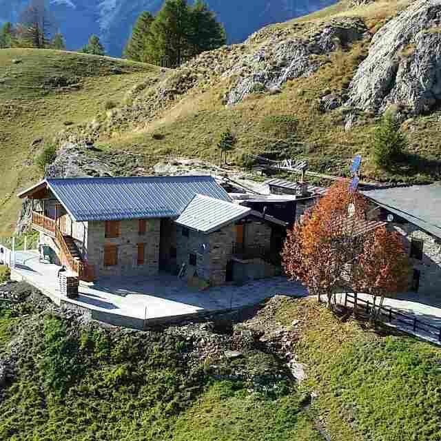
Rifugio G. Bertone
- Altitude : 2000m
- Capacity : 50 pers.
- COURMAYEUR
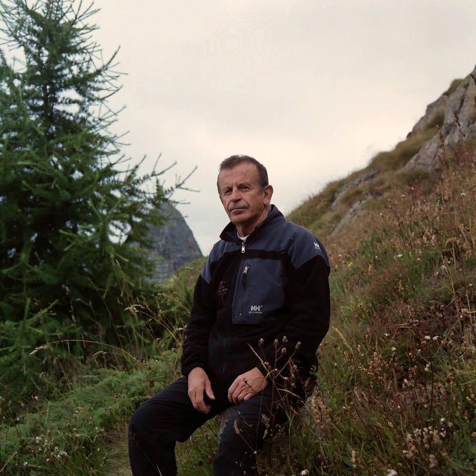
Lorenzino COSSON
11013 COURMAYEUR
Phone number: 0039 347 032 57 85
Mobile phone number: 0039 347 032 57 85
Off-season phone number: 0039 347 032 57 85
Find your next stay :
Click on the green boxes below to book this mountain hut :
juillet - 2026
août - 2026
octobre - 2026
novembre - 2026
janvier - 2027
février - 2027
avril - 2027
mai - 2027
juillet - 2027
août - 2027
octobre - 2027
novembre - 2027
janvier - 2028
février - 2028
avril - 2028
mai - 2028
Legend :
Available
Last seats available
Full or closed
Not available for online booking (please contact the mountain hut)
Other mountain huts
Other mountain huts
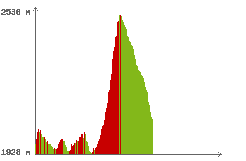
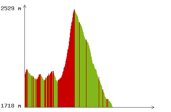
 Tour of Mont Blanc in an anti-clockwise direction
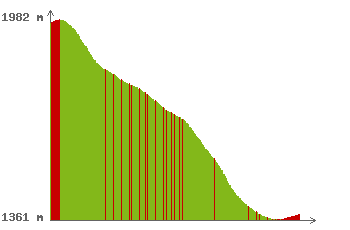
Hôtel Lavachey - 02 h 31 mn - 7.4 km 352m D+ / 676m D-
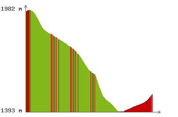
Hôtel Chalet Val Ferret - 03 h 39 mn - 12.8 km 355m D+ / 367m D-
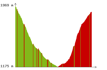
Gîte Alpage de La Peule - 05 h 58 mn - 20.9 km 864m D+ / 758m D-
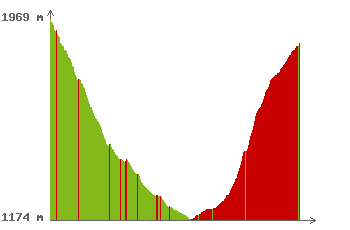
Hotel du Col de Fenêtre - 07 h 10 mn - 25.1 km 869m D+ / 1120m D-
Gîte La Léchère - 07 h 25 mn - 26.0 km 857m D+ / 1143m D-
Chalet 'Le Dolent' - 07 h 48 mn - 27.3 km 881m D+ / 1231m D-

Gîte de la Fouly - 07 h 55 mn - 27.7 km 903m D+ / 1266m D-
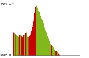
Hôtel Edelweiss - 07 h 57 mn - 27.8 km 892m D+ / 1258m D-
Relais d'Arpette - 11 h 47 mn - 41.3 km 1496m D+ / 1825m D-
Pension en Plein Air - 12 h 16 mn - 43.0 km 1357m D+ / 1842m D-
Auberge Gîte Bon Abri - 12 h 39 mn - 44.3 km 1383m D+ / 1911m D-

Chalet La Grange - 12 h 40 mn - 44.4 km 1376m D+ / 1907m D-
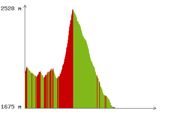
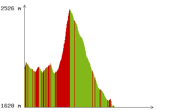
 Clockwise tour of Mont Blanc
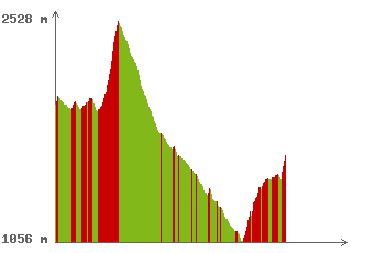
Hôtel Funivia - 01 h 25 mn - 1.5 km 44m D+ / 638m D-
Rifugio Chapy Mont Blanc - 01 h 37 mn - 1.9 km 125m D+ / 603m D-
Rifugio Monte Bianco - Cai Uget - 04 h 11 mn - 9.2 km 756m D+ / 834m D-
Gite le Randonneur du Mont Blanc località Pra Neyron Checrouit 11013 Courmayeur Aosta Italia - 04 h 12 mn - 9.2 km 759m D+ / 838m D-

Rifugio Maison Vieille - 04 h 29 mn - 9.8 km 836m D+ / 855m D-
Refuge des Mottets - 09 h 55 mn - 28.0 km 1821m D+ / 1925m D-
Description
The Giorgio Bertone Refuge (2,000 m above sea level) is located in the Aosta Valley in the Pennine Alps in the municipality of Courmayeur. It is located northeast of the town and overlooks the Mont Blanc massif. It is located along the Alta Via No. 1 of the Aosta Valley.
The refuge was built in 1982 in memory of the mountaineer Giorgio Bertone, who died in a plane crash below the summit of Mont Blanc du Tacul in 1977.
The refuge can be reached via a panoramic hike that varies in its route, starting from Plampincieux, a locality at the entrance to the Val Ferret.
We recommend stopping at the orientation table, where the view is unparalleled.
Alternatively, you can depart directly from Courmayeur via the Val Sapin.
What this accommodation offers
Facilities
- Bar
- Terrace
Languages spoken
- English
- French
- Italian
Payment methods
- Accepts euros
- Bank card
- Species
Services
- Half Board
- Breakfast
- Picnic
- By reservation
- Evening meal
Services offered
- Hot showers for a fee
- Electricity (220v)
- Weather information
- Wi-Fi (free)
Access
1) From Val Ferret, starting just ahead of Plampicieux, from the bridge with a sign indicating the route to Rifugio Bertone, path no. 31 - 1.5 hours' walk. A picturesque and panoramic route, on the large balcony overlooking Mont Blanc. Ideal for families with children and for those who want to take some great photos!
2) From Val Sapin, starting from Courmayeur, more precisely from Villair Superiore, on path no. 42 - 1.5 hours' walk on a slightly steeper trail, suitable for more experienced hikers.
Additional information
Important times and information:
Check-in 4:00 pm - 6:00 pm
It is very important to respect the timetable: this way you can relax before dinner and inform the kitchen in time of any food allergies or intolerances.
Dinner 7:30 pm
The common room closes at 9:30 pm
Breakfast 7:00 am - 7:30 am
Check out no later than 8.00 am
After 6:00 pm, we will consider your beds free and we may assign them to other customers.
Logistics note:
As the refuge is at 2,000 metres, we are supplied once a week by helicopter, weather permitting. We do not always have all the raw materials available: we therefore ask for your understanding and a spirit of adaptation.
What to bring:
Sleeping bag
Towel
Slippers
Bathroom kit
Room rules:
Eating and drinking is not allowed in the rooms and dormitories.
Backpacks are not allowed on the bed. Please use the side of the bed and/or the appropriate containers.